Both Amanda Madden, assistant professor of history at George Mason University’s Roy Rosenzweig Center for History and New Media, and her colleague Rachel Midura at Virginia Tech have extensive experience as digital historians specializing in the history of information. Over the years, Madden and Midura have learned that while working with current or historical maps, it is important to ask the question, “What is not included in this map? What past conditions — including settlement patterns, road networks, shifting political boundaries, and altered coastlines and waterways are not integrated that might tell a deeper story about the area?”
While Madden and Midura have developed the skills to look deeper at what is missing from maps, they know that is difficult to integrate these important skills into traditional classroom settings. “Students often face a real psychological barrier when learning technical skills in formal instructional contexts – they are reluctant to ask questions, experiment freely, and are concerned about potentially faltering in front of instructors and peers,” explains Madden. However, Madden and Midura recognized the present and growing call for researchers to be proficient in digital mapping skills.
The two shared a passion to develop a framework which would give students an opportunity to learn these valuable skills in a meaningful way. After receiving Madden’s proposal, “Historical Mapathons: Team-Based GIS Training and Transformation of Seventeenth-Century Maps,” 4-VA agreed, and the team was awarded a grant to address this challenge. Madden solicited Jessica Otis of George Mason, and Midura called on Jessica Taylor at VT to work on the project.



Together, they developed a model based on the mapathon concept — creating a low-stakes, hands-on environment where students could build digital skills through experimentation and peer learning, free from the evaluative pressures of a course setting. To do so, they piloted a collaborative model for the crowd-sourced creation of an open, authoritative repository of historical Geographic Information System (GIS) layers — one designed to be accessible to researchers and students across institutions and career stages.
The team held a series of meetings to build the structure and flow of the mapathons. They identified participant needs and designed the events to incorporate the broader objectives of building a shared historical GIS frame. In parallel, Otis and Taylor developed training materials tailored to participants at varying levels of GIS experience with the goal of creating an inclusive, collaborative environment for both undergraduate and graduate students.
Their next step was to put the plan into action. They scheduled a mapathon event at both George Mason University and Virginia Tech.
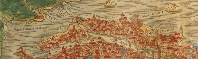
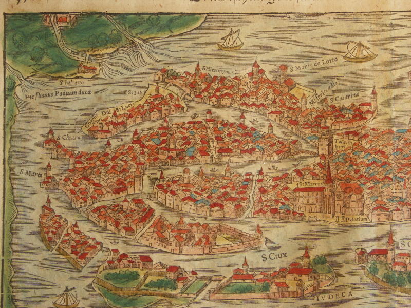
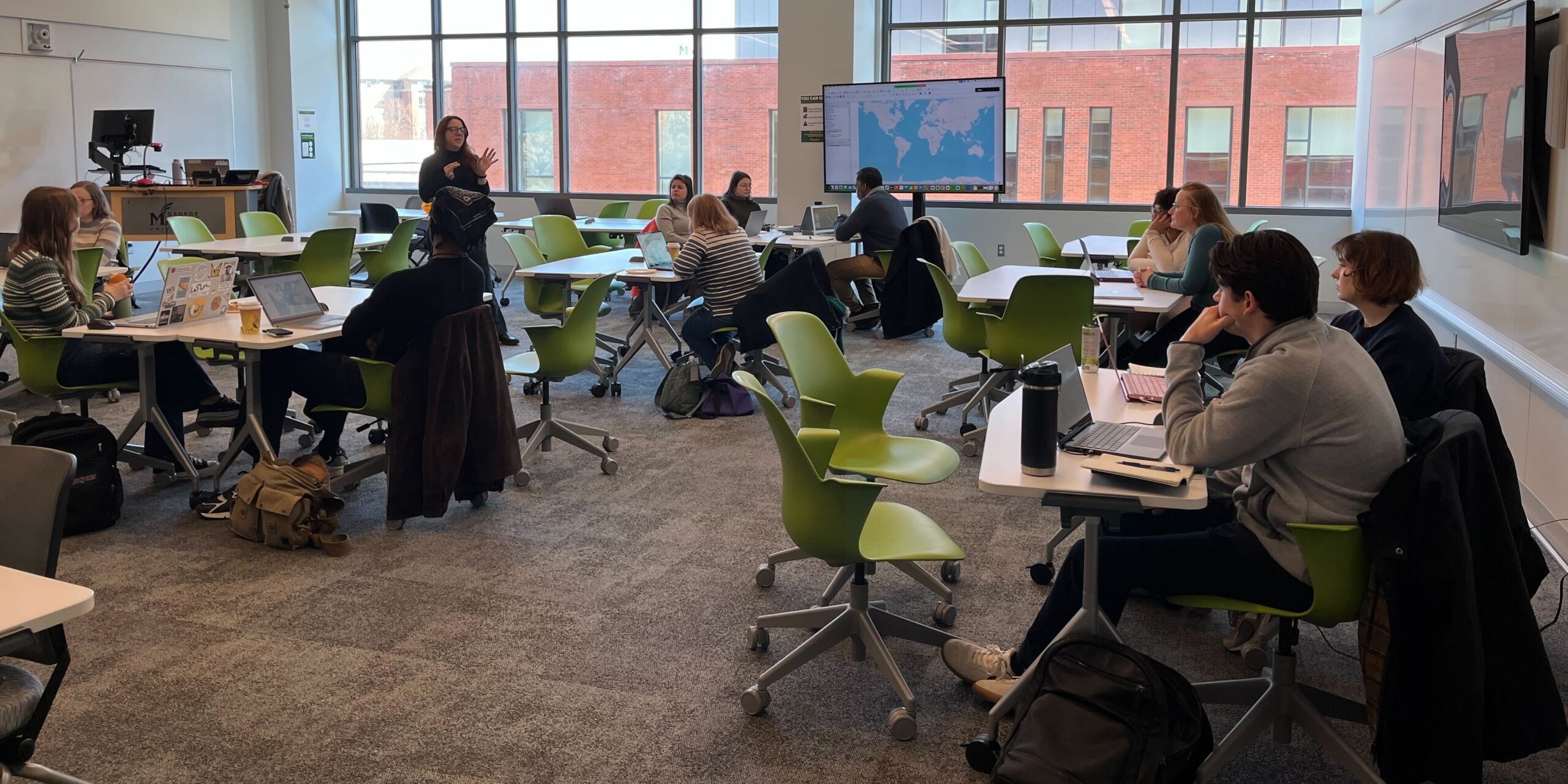
The first mapathon at George Mason attracted 25 undergraduate and graduate students. The event introduced participants to collaborative historical GIS workflows, with hands-on training centered on the digitization of geospatial features from two seventeenth-century Venetian maps. Over the course of the day, students collectively produced a library of early modern shapefiles, contributing directly to a shared historical layer repository.
Participant feedback was strongly positive, with students noting both the accessibility of the training format and the value of working collaboratively on a shared dataset. “The response made it clear that this was a format students genuinely needed,” says Madden.
A decision was made to host a follow-up event at George Mason due to the interest generated by the initial session and the rejoinder from students unable to attend. Fifteen students participated at the second mapathon. Midura drove from Blacksburg to be part of the day, and saw firsthand the enthusiasm students showed for the collective approach to GIS learning.
A third mapathon was held at Virginia Tech. Three graduate teaching assistants from George Mason University — Cassandra Farrell, Savannah Scott, and Lazlo Taba — traveled to Virginia Tech to help facilitate the session, cementing the team’s commitment to build a truly collaborative, cross-institutional training model. At the third mapathon, participants were introduced to Recogito, a platform for annotating and georeferencing historical maps and texts. This addition allowed the expansion of the methodological range for the training series and gave students further hands-on experience with a complementary set of digital humanities tools.
All three mapathon events were well received, with students consistently noting the value of the collaborative, hands-on format and the opportunity to contribute to a real research dataset.
The interest generated by the series continues to expand. Students have subsequently reached out to request additional training opportunities, confirming that the mapathon model successfully fostered genuine ongoing engagement with historical GIS and digital humanities methods rather than just a one-time participation.
Grant funds were used to hire research assistant Katie Kania to develop tutorials and instructional resources based on the training materials and workflows piloted at the events, producing reusable, publicly accessible resources that would extend the reach of the project beyond the original participant cohort and support future historical GIS and Recogito training efforts. The results are now available on an open platform to share with a broader audience.
Madden plans to continue releasing tutorials and instructional resources, with the goal of completing a publicly accessible suite of materials covering the full range of tools and workflows introduced across the mapathon series. In addition, Otis and Taylor are currently co-authoring an article on the project’s methodological and pedagogical contributions — including the viability of the crowd-sourced, cross-institutional mapathon model for building shared historical GIS infrastructure, the challenges of training participants with varying levels of technical experience, and the potential for scaling this approach to other regional and thematic contexts. The article will contribute to ongoing conversations in the digital humanities about sustainable, community-driven approaches to historical geospatial data creation.
The project’s impact has also extended beyond the university classroom. Farrell, one of the graduate teaching assistants who is a PhD student in the Department of History at George Mason and a librarian at the Library of Virginia, is drawing directly on her experience with the project. She has developed and hosted her own public-facing mapathon, demonstrating the model’s adaptability beyond an academic training context and its potential to engage broader public audiences in collaborative historical geospatial work.
“The mapathon model proved to be a demonstrably effective approach to digital skills training, both in terms of participant engagement and tangible research outputs,” says Madden. Building on this success, Otis and Taylor plan to expand the series during the next academic year, with several additional mapathon events planned across both institutions. These future events will expand the educational resources, refined workflows, and lessons learned from the inaugural series, with the aim of deepening the project’s reach among students and contributing further to the shared historical geospatial infrastructure the project has already developed.
Looking ahead, Madden plans to seek external funding to support the development of an interactive website that would serve as a comprehensive, publicly accessible hub for the project’s growing collection of historical geospatial resources. Explains Madden, “The platform will consolidate the tutorials, shapefiles, and educational materials produced through the mapathon series into a single, user-friendly environment, making them more discoverable and usable for researchers, educators, and students working with early modern historical data across institutions.”
Concludes Madden, “The gap between student interest and student confidence in this area has been something I have wanted to address for some time. This grant gave me the resources and the collaborative framework to do that. Thanks to 4-VA and our team, we were able to successfully reach, and surpass, our goals!”


 Professor in George Mason’s College of Science, Department of Biology, saw an opportunity to combine the experience and knowledge of other experts in the field to develop a novel genomic tool to address this issue.
 remain In the wild, there are approximately 160 bongos in U.S. zoos and several hundred more on private ranches. As such, breeding and transfer strategies that increase genetic diversity and reduce inbreeding of captive animals are critical for the survival of the species.
 GMU researchers, Lim and his PhD student, Karen Holm, assembled their team — Aakrosh Ratan, Assistant Professor, University of Virginia; Klaus-Peter Koepfli, Senior Research Scientist, Smithsonian Mason School of Conservation; and Budhan Pukazhenthi, Research Physiologist, Smithsonian Conservation Biology Institute. 4VA funding was used to purchase the necessary supplies, reagents and equipment including DNA tests and probe sets.
 centers and zoos were collected to begin the project. This resulted in a total of 207 samples from both current and historical ex situ populations (populations outside of the native ranges). They evaluated the effectiveness of the probe-set in generating high-quality genetic data from different sample types and for different genetic marker types. The data obtained are now being accessed for their ability to produce accurate information on animal kinship, genetic diversity and population structure, which will ultimately be used to guide precise captive breeding programs.
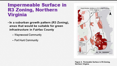
 That was just the challenge Younsung Kim in Mason’s Department of Environmental Science and Policy wanted to take on. Kim, who has an extensive background in complex environmental and sustainability issues, saw the potential of incorporating freely available data from US Geological Society and Census Bureau along with the local county government land use zoning data to create a computational spatial model to help identify what works, and what doesn’t work, in GI.
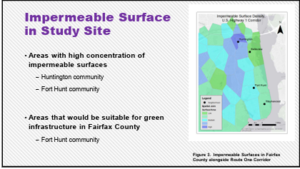 Finally, Kim wanted to incorporate today’s trends in GI architecture in the research; identifying UVA’s School of Architecture as a leading source of urban planning and spatial analysis expertise.
 Political Science Association Conference, and at a Mason Earth Day event. A paper entitled “Mapping Green Infrastructure from Stormwater” was published in Environmental Pollution and Climate Change.